Family and Kids
2010 Year of Hiking – Jahr des Wandern: Swiss trails for the entire family
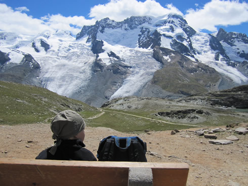
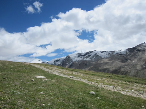
Admiring the view of the glaciers in Wallis
Have you ever hiked in Switzerland? If not, try it out like 1/3 of the Swiss population. It is one of the most popular sports in the country along with cycling.
If the Swiss are not hiking, 3/4 walk, jog or do Nordic walking.
According to a “Sport Schweiz 2008” study by the Swiss Hiking Trails, about 2 Million Swiss hike on a regular basis for at least a duration of 3.5 hours. Moreover, they do about 20 hikes yearly.
The study shows that most hikes are done in the German speaking part of Switzerland with 39%, followed by the South Canton of Ticino with 22%.
But how could one not be motivated to hike in Switzerland with so many beautiful mountains, lakes and country paths to choose from? And this is not the only motivation, first you need the trails
and a good signing system, which Switzerland has.
Hiking to Sunnegga, Furggji 9780 feet/2981 meters (Wallis)
In Switzerland this year, you will see many signs and books about hiking, Randonnée (French), Gita (Italian) or Wanderung (German). You may even have noticed everywhere in the big cities on the windows of the bank UBS or in the supermarket magazine COOP, the phrase “Jahr des Wandern 2010”.
What is it all about? Why is hiking on everyone’s mind this year?
Each time the word hiking is pronounced, I listen. Is there a hike someone recommends I have not done and is an absolute to do?
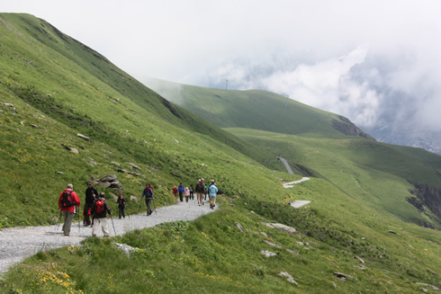
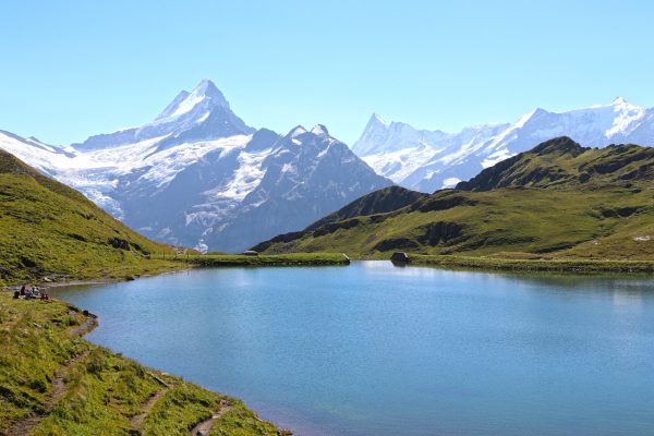
hiking to Bachalpsee in Graubunden
What’s happening in Switzerland is simple. To commemorate the 75 jubilee of the Swiss trails (2009), many organizations and businesses have joined forces to put together things related to hiking.
Switzerland can be proud with its 39630 miles 763,779 km of hiking trails in a country with just 44303 miles/71,300 km of roads.
It all started when a Swiss teacher Jakob Ess went hiking in the Klausenpass (Cantons of Uri & Glarus) with his students in the 1900’s. Then more and more cantons decided to prepare trails. The first signalization with signs arrived in 1934 with the beginning of Swiss Hiking.
90% of the Swiss are satisfied with the trails and signalization.
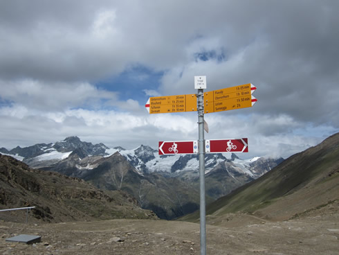
How do the signs work?
Depending if where you are hiking to, you get different colors, white/blue/white for alpine trails and white/red/white for mountain trails for instance. Yellow signs tell you the names of the places you can hike to with the time frame without breaks.
The National roads are marked with 1 digit number from 1 to 6 like the Alpenpanorama or the Via Alpina. The regional roads have two digit numbers. The photo below shows the Zurichsee Weg, Road 84.
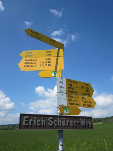
Sign for hiking trails around the Zurich lake
Here are some interesting facts from the study of 2009:
- the highest number of hiking members is in the Canton of Berner Oberland with 12,191.
- Graubunden has the largest number of trails with 6749 miles/10,862 km just behind the Berner Oberland canton.
- The cantons of Berner Oberland and Zurich among a few others are cantons where there are more people signed up than miles of trails. In Zurich there are more than twice the number of members than the number of trails in miles.
- Graubunden is the place with the most hiking trails in the mountains (6028 miles/9702 km) compared to only 9,9 miles/16 km in Zurich.
- The Canton of Ticino has a lot of trails 2275 miles/3662 km with most of them being in the mountains but only 455 members!
- Another canton with many hiking trails is Sarganz (SG) with 2454 miles/3950 km.
- Most walkers are located in the German speaking part of Switzerland not in the “Röstigraben”.
- More and more people are hiking in the mountains and less are walking are doing normal city or country hiking (results from 2000-2008).
- Only 40% of hikers use walking sticks.
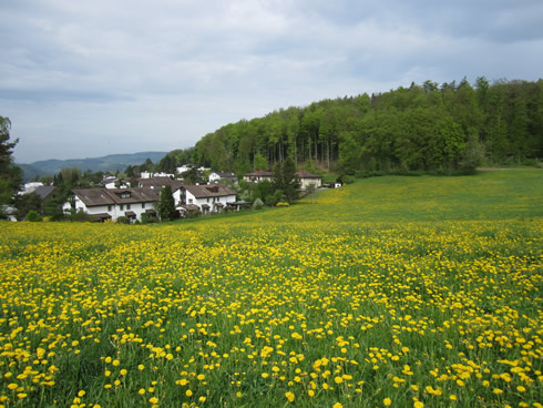
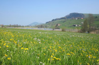
Trail near Zurich in early morning
Partners such as Schweiz Tourismus, Schweiz Mobil, UBS and alpine clubs have put together in a magazine the best 32 hikes in the entire Switzerland. Plus the 12 nicest ones have new signs.
Anyone can get the magazine at UBS. It offers a quick description of the hikes with a small map, number of km, time needed and degree of difficulty. Also it tells you how to get there and gives an idea for hotels and restaurants. For more information it refers you to MySwitzerland.com with a search number for each hike.
How could it be more simple! Plus the internet has links to Google Earth maps and you can register to have the maps sent to your I-phone.
Interested to find out more about:
- Plan & Go wandermaps
- UBS – Der Wanderverfüher
- Coop has excellent hiking books “Zu Fuss Unterwegs” for mountains, cities and lakes
- Third National Hiking Tag on Sept. 18th: three guided walks from 6 to 10 km are offered in the Canton of Wallis in Goms. Check out www.schweizerfamilie.ch
- Check out Schweiz Tourismus website.
Trail above Zermatt in Wallis
Some hikes to Lavaux wine trails (Geneva), to the Aletsch glacier (Wallis), to the lakes trail (Wallis) or to the Eiger trails (Berner Oberland) look really amazing.
I can’t wait to try them out this Fall. Have fun hiking!
Related Posts
News: Zurich celebrates 100 years of its steamboat ‘Stadt Zurich’
Summer Holidays 2020 – Spotlight on Switzerland: hiking and cycling in the stunning Bernese Oberland
Preparing for the Züri-Fäscht: July 2-4th in Zurich (Switzerland)
May 3, 2010 – Photo of the week
Visit Burkliplatz Market in Zurich: beautiful in all seasons